Hiking
Show the climb, not just the view
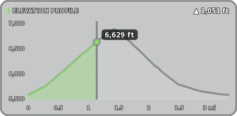
Summit footage rarely shows how hard the trail was. Data Overlay turns the GPS track from your watch or phone into an elevation profile with a dot that moves along it, plus elevation, gain, distance, grade, pace and heart rate.
Free trial, then from $19.99 a month, $79.99 a year or $129.99 once. See pricing
Live demo
Try Hiking mode right here
This is the real app running in your browser on a sample hike. Turn gauges on and off, drag them around, change units and colours, and scrub through it. Opening your own files and exporting happen in the desktop app.

Sample data only. Works best on a computer. Open the demo full screen
What it shows
Every gauge in Hiking mode
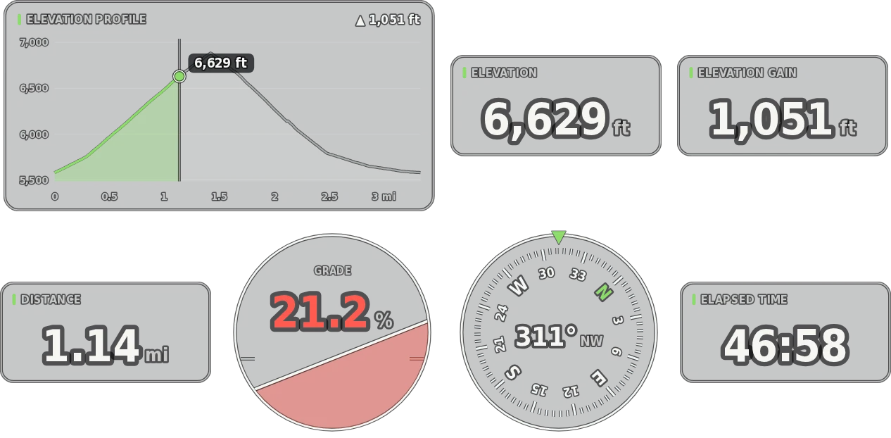
Start with the main gauges, add the essentials, or turn on everything. Size, move and colour each one, in imperial or metric units.
Main gauges
- Elevation profile
Numbers
- Elevation
- Elevation gain
- Distance
- Pace
- Heart rate
- Elapsed time
- Speed
- Temperature
More gauges
- Grade
- Compass
- GPS position
- Mini-map
- Heart-rate zones
- Elevation profile with a moving dot, drawn across distance or time.
- Grade dial that changes colour as the trail gets steeper.
- Compass and GPS position in degrees and minutes, decimal degrees or degrees, minutes and seconds.
- Mini-map of your route.
- Heart-rate zones from your max or resting heart rate.
- Imperial or metric, your choice.
Your files
Works with the log you already have
- Garmin watches FIT or GPX
- Apple Watch through HealthFit, RunGap or WorkOutDoors
- Strava GPX or TCX downloads
- Phone GPS apps GPX or KML
Reads GPX, FIT, TCX, KML and CSV
Tip
Apple Watch: export the hike with HealthFit, RunGap or WorkOutDoors (FIT or GPX), or download the GPX from Strava.
Combine files
Use more than one file at once, for example the GPS track from your phone and heart rate from your watch. Each gauge uses the best file that has its data, and each file gets its own clock offset.
Built for the edit
Made to drop straight into your timeline
- ProRes 4444 · PNG MOV · PNG sequence
Transparent, frame-exact exports
ProRes 4444 with alpha on a Mac, or lossless PNG on either platform. Export at your sequence’s frame rate and the overlay has exactly as many frames as your clip.
- ±0.1 s
Sync to the frame
Nudge each file’s clock in tenths of a second until the gauges match the picture. Files recorded on a local clock are lined up with UTC files for you.
- Best source for each gauge
Combine files
Take GPS from one device and heart rate or power from another. Each gauge uses the best file that has its data, with a clock offset for each file.
- Row · Stacked · Panel · Custom
Arrange it your way
Drag gauges anywhere with snapping guides, size each one, pick colours and units, and undo any change. The export frame fits your arrangement.
- Every CPU core
Fast, even for long days
Exports use every core, so an hour of footage renders in minutes. On Macs with a ProRes engine, encoding runs in hardware.
- Local processing
Your files stay on your computer
Logs and videos are read and rendered on your own machine. Nothing is uploaded.
Try it on your own hike
The free trial is the full app with every sport. Exports are 5 seconds long with a watermark until you buy. From $19.99 a month, $79.99 a year or $129.99 once.